- Home
- Snow Information
- National Analyses
- Interactive Maps
- 3D Visualization
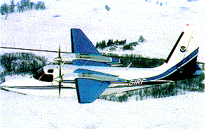
- Airborne Surveys
- Snowfall Analysis
- Satellite Products
- Forecasts
- Data Archive
- SHEF Products
- Science/Technology
- NOHRSC
- GIS Data Sets
- Special Purpose Imagery
- About The NOHRSC
- Staff
- NOAA Links
- Snow Climatology
- Related Links
- Help
- Help and FAQ
- Site Map
- Contact Us
- Please Send Us Comments!

|
2003 - 2004 Snow Season Surveys >
 |
2004 Central & East Snow Survey
February 15, 2004 to February 24, 2004
|
|
The Central and Eastern Snow Survey began February 15, 2004 and was concluded on February 24, 2004 after completing 138 lines.
|
|
|
|
Flightline Status |

|
| Date |
States |
Status Map |
Flight Line SHEF Product |
SNODAS SWE Image |
Interpolated Gamma SWE Image |
| 2004-02-24 |
NY,VT |
2004-02-24 |
2004-02-24 |
2004-02-24 |
2004-02-24 |
| 2004-02-23 |
NY,VT |
2004-02-23 |
2004-02-23 |
2004-02-23 |
2004-02-23 |
| 2004-02-20 |
MA,NY,VT |
2004-02-20 |
2004-02-20 |
2004-02-20 |
N/A |
| 2004-02-19 |
CT,MA,NY,PA,VT |
2004-02-19 |
2004-02-19 |
2004-02-19 |
N/A |
| 2004-02-18 |
MD,OH,PA,WV |
2004-02-18 |
2004-02-18 |
2004-02-18 |
N/A |
| 2004-02-17 |
MI,MN,WI,ON |
2004-02-17 |
2004-02-17 |
2004-02-17 |
2004-02-17 |
| 2004-02-16 |
IA,MI,MN,WI,ON |
2004-02-16 |
2004-02-16 |
2004-02-16 |
2004-02-16 |
| 2004-02-15 |
IA,MN,SD |
2004-02-15 |
2004-02-15 |
N/A |
N/A |
|
|


