(content link) weather.gov    
NOAA link
National Weather Service
  NWS link
National Operational Hydrologic
Remote Sensing Center

2002 - 2003 Snow Season Surveys >

Aero Commander Image

2003 Alaska Snow Survey

April 10, 2003 to April 17, 2003

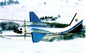
The Alaska Snow Survey was completed on April 17, 2003 after collecting data for 107 flightlines. Regions in the survey included the Brooks Range, the Alaska Range, east of Fairbanks, the Kenia Peninsula, the Wrangell Mountians, and the Talkeetna Mountains.

Flightline Status

Gamma Status


Date States Status Map Flight Line SHEF Product SNODAS SWE Image Interpolated Gamma SWE Image
2003-04-17 AK 2003-04-17 2003-04-17 2003-04-17 N/A
2003-04-16 AK 2003-04-16 2003-04-16 2003-04-16 N/A
2003-04-15 AK 2003-04-15 2003-04-15 2003-04-15 N/A
2003-04-14 AK 2003-04-14 2003-04-14 2003-04-14 N/A
2003-04-12 AK N/A 2003-04-12 2003-04-12 N/A
2003-04-11 AK N/A 2003-04-11 2003-04-11 N/A
2003-04-10 AK N/A 2003-04-10 2003-04-10 N/A


NOHRSC
Mission Statement  |  Contact


National Weather Service
National Operational Hydrologic Remote Sensing Center
Office of Water Prediction
1735 Lake Drive W.
Chanhassen, MN 55317

NOHRSC homepage
Contact NOHRSC
Glossary
Credits
Information Quality
Page last modified: Feb 27, 2023 - cloud
About Us
Disclaimer
Privacy Policy
FOIA
Career Opportunities