Devils Lake, ND - 2011-06-03
|
The LANDSAT-5 TM image is a false-color composite
depicting the extents of Devils Lake in eastern
North Dakota.
The TM bands 5, 4, and 3 are displayed as Red, Green,
and Blue.
This scene is GIS-ready with the additional
.jgw file.
|

|
|
Flooding in North Dakota - 2011-06-01
|
The LANDSAT-5 TM image is a false-color composite
depicting the flooding along the rivers in western and
central North Dakota, extending up into Canada.
The TM bands 5, 4, and 3 are displayed as Red, Green,
and Blue.
This scene is GIS-ready with the additional
.jgw file.
|

|
|
Red River from Pembina, ND to Morris, MB - 2011-04-25
|
The LANDSAT-5 TM image is a false-color composite
depicting the swollen banks of the Red River as it flows
north along the border of Minnesota and North Dakota into
Manitoba, Canada. The towns of Pembina, ND and
St. Vincent, MN can be seen at the bottom of the image,
just south of the US-Canada border at Emerson, MB.
The town of Morris, MB sits as a near-island in the
upper center of the image.
The TM bands 5, 4, and 3 are displayed as Red, Green,
and Blue. The projection is UTM Zone 14N. The scenes
used were L5030026_02620110425 and L5030027_02720110425.
This scene is GIS-ready with the additional
.jgw file.
|

|
|
Red River at Grand Forks, ND - 2011-04-25
|
The LANDSAT-5 TM image is a false-color composite
depicting the swollen banks of the Red River as it flows
north along the border of Minnesota and North Dakota.
Grand Forks, ND can be seen on the western side of the
split at the bottom righthand corner of the image.
The TM bands 5, 4, and 3 are displayed as Red, Green,
and Blue. The projection is UTM Zone 14N. The scenes
used were L5030026_02620110425 and L5030027_02720110425.
This scene is GIS-ready with the additional
.jgw file.
|

|
|
Red River at Fargo, ND - 2011-04-25
|
The LANDSAT-5 TM image is a false-color composite
depicting the swollen banks of the Red River as it flows
north along the border of Minnesota and North Dakota
from Fargo, ND to just south of Grand Forks, ND.
The TM bands 5, 4, and 3 are displayed as Red, Green,
and Blue. The projection is UTM Zone 14N. The scenes
used were L5030026_02620110425 and L5030027_02720110425.
This scene is GIS-ready with the additional
.jgw file.
|

|
|
Devils Lake, ND - 2011-04-23
|
The LANDSAT-5 TM image is a false-color composite
depicting the swollen extents of Devils Lake and
environs. Devils Lake is the large lake to the south, with
Pelican Lake just north divided by the east-west County
Road 19. Above that are the once-separated Lake Irvine,
Lake Alice, Chain Lake, Mikes Lake, and Dry Lake. To the
east of those are Morrison Lake and Sweetwater Lake.
The TM bands 5, 4,
and 3 are displayed as Red, Green, and Blue. The scene
used was L5032026_02620110423.
This scene is GIS-ready with the additional
.jgw file.
|

|
|
Minnesota River from New Ulm to Chaska, MN - 2011-04-04
|
The LANDSAT-5 TM image is a false-color composite
depicting the swollen banks of the Minnesota River and
ice on the surface of the nearby lakes.
The TM bands 4, 3,
and 2 are displayed as Red, Green, and Blue.
This scene is GIS-ready with the additional
.jgw file.
|

|
|
Headwaters of the Red River of the North - 2011-04-02
|
The LANDSAT-5 TM image is a brightened false-color
composite showing the headwaters of the Red River of the
North along the Minnesota / Dakota border. Fargo/Moorhead
is visible up top, with Wahpeton and Lake Traverse further
south. The image is projected in UTM Zone 15 north.
The TM bands 4, 3, and 2 are displayed as Red, Green, and Blue.
This scene is GIS-ready with the additional
.jgw file.
|

|
|
Western Minnesota from Red Lake to Fargo, ND - 2011-04-02
|
The LANDSAT-5 TM image is a brightened false-color
composite showing western Minnesota. Red Lake is visible
in the upper righthand corner, as well as Fargo/Moorhead
along the Red River to the lower left.
The image is projected in UTM Zone 15 north.
The TM bands 4, 3, and 2 are displayed as Red, Green, and Blue.
This scene is GIS-ready with the additional
.jgw file.
|

|
|
Big Sioux River from Florence to Dell Rapids, SD - 2011-04-02
|
The LANDSAT-5 TM image is a brightened false-color
composite showing the Big Sioux River in eastern
South Dakota. The headwaters of the Minnesota River
are also visible in the upper right.
The image is projected in UTM Zone 15 north.
The TM bands 4, 3, and 2 are displayed as Red, Green, and Blue.
This scene is GIS-ready with the additional
.jgw file.
|
|
|
Minnesota River from Montevideo to Henderson, MN - 2011-03-26
|
The LANDSAT-5 TM image is a false-color composite
depicting the swollen banks of the Minnesota River
as well as the the edge of the snow line. The TM bands 4, 3,
and 2 are displayed as Red, Green, and Blue.
This scene is GIS-ready with the additional
.jgw file.
|

|
|
Mississippi River at St Paul, MN - 2010-10-03
|
The LANDSAT-5 TM image is a false-color composite
depicting flooding near the confluence of the
Minnesota and Mississippi Rivers. The TM bands 7, 5,
and 2 are displayed as Red, Green, and Blue.
This scene is GIS-ready with the additional
.pgw file.
|

|
|
Mississippi River at Hastings, MN - 2010-10-03
|
The LANDSAT-5 TM image is a false-color composite
depicting flooding along the Mississippi River on the
Minnesota-Iowa border. The TM bands 7, 5, and 2 are
displayed as Red, Green, and Blue.
This scene is GIS-ready with the additional
.pgw file.
|

|
|
Mississippi River at Red Wing, MN - 2010-10-03
|
The LANDSAT-5 TM image is a false-color composite
depicting flooding along the Mississippi River on the
Minnesota-Iowa border. The TM bands 7, 5, and 2 are
displayed as Red, Green, and Blue.
This scene is GIS-ready with the additional
.pgw file.
|

|
|
Mississippi River at Onalaska, WI - 2010-10-03
|
The LANDSAT-5 TM image is a false-color composite
depicting flooding along the Mississippi River on the
Minnesota-Iowa border. The TM bands 7, 5, and 2 are
displayed as Red, Green, and Blue.
This scene is GIS-ready with the additional
.pgw file.
|

|
|
Mississippi River at La Crosse, WI - 2010-10-03
|
The LANDSAT-5 TM image is a false-color composite
depicting flooding along the Mississippi River on the
Minnesota-Iowa border. The TM bands 7, 5, and 2 are
displayed as Red, Green, and Blue.
This scene is GIS-ready with the additional
.pgw file.
|

|
|
Des Moines and Skunk Rivers near Oskaloosa, IA - 2010-08-16
|
The LANDSAT-5 TM image is a false-color composite
depicting the extensive flooding along the Des Moines
and Skunk Rivers in Iowa. The TM bands 7, 5, and 2 are
displayed as Red, Green, and Blue. The
scene used was LT50260312010228.
A .kmz file suitable for viewing with KML interpreters
(such as Google Earth) can be found
here.
This scene is GIS-ready with the additional
.jgw file.
|

|
|
Des Moines and Skunk Rivers near Pella, IA - 2010-08-16
|
The LANDSAT-5 TM image is a false-color composite
depicting the extensive flooding along the Des Moines
and Skunk Rivers in Iowa. The TM bands 7, 5, and 2 are
displayed as Red, Green, and Blue. The
scene used was LT50260312010228.
This scene is GIS-ready with the additional
.jgw file.
|

|
|
Des Moines and Skunk Rivers near Des Moines, IA - 2010-08-16
|
The LANDSAT-5 TM image is a false-color composite
depicting the extensive flooding along the Des Moines
and Skunk Rivers in Iowa. The TM bands 7, 5, and 2 are
displayed as Red, Green, and Blue. The
scene used was LT50260312010228.
A .kmz file suitable for viewing with KML interpreters
(such as Google Earth) can be found
here.
This scene is GIS-ready with the additional
.jgw file.
|

|
|
South Skunk River at Colfax, IA - 2010-08-16
|
The LANDSAT-5 TM image is a false-color composite
depicting the extensive flooding along the Skunk River
in Iowa. The TM bands 7, 5, and 2 are displayed as Red,
Green, and Blue. The scene used was LT50260312010228.
A .kmz file suitable for viewing with KML interpreters
(such as Google Earth) can be found
here.
This scene is GIS-ready with the additional
.jgw file.
|

|
|
Devils Lake, ND - 2010-05-15
|
This LANDSAT 5 TM image is a false-color composite
using bands 4-3-2 as Red-Green-Blue.
The latest observed stage is 1451.65 ft at
2:00 PM on 5/17.
This scene is GIS-ready with the additional
.jgw file.
|
|
|
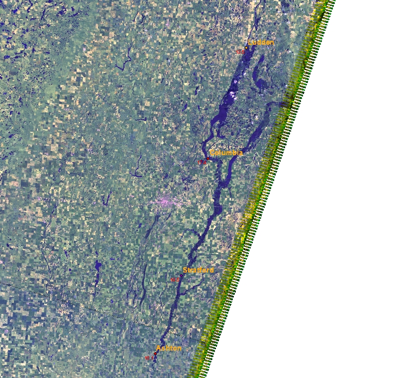
James River near Ludden, ND - 2010-05-08
|
This LANDSAT 5 TM image is a false-color composite
using bands 7-5-2 as Red-Green-Blue. The James River
near Ludden is slowly receding, but still in
flood. Ludden retails a large transient lake south of
the city.
The latest river stage near Ludden is 13.6 ft at
12:30 PM on 5/11. Flood stage is 12.0 ft
This scene is GIS-ready with the additional
.jgw file.
|

|
|
James River near Columbia, SD - 2010-05-08
|
This LANDSAT 5 TM image is a color composite
using bands 3-2-1 as Red-Green-Blue. The James River
near Columbia is slowly receding, but still in moderate
flood.
The latest river stage near Columbia is 17.36 ft at
2:31 PM on 5/11. Flood stage is 13.0 ft
This scene is GIS-ready with the additional
.jgw file.
|

|
|
James River near Stratford, SD - 2010-05-08
|
This LANDSAT 5 TM image is a color composite
using bands 3-2-1 as Red-Green-Blue. The James River
near Stratford is slowly receding, but still in moderate
flood.
The latest river stage near Stratford is 18.29 ft at
2:00 PM on 5/11. Flood stage is 14.0 ft
This scene is GIS-ready with the additional
.jgw file.
|

|
|
James River near Ashton, SD - 2010-05-08
|
This LANDSAT 5 TM image is a color composite
using bands 4-3-2 as Red-Green-Blue. The James River
near Ashton is slowly receding, but still in major
flood. The bridge three miles NNE of the gauge is
underwater (obscured by clouds in this scene).
The latest river stage near Ashton is 16.9 ft at
3:00 PM on 5/11. Flood stage is 13.0 ft
This scene is GIS-ready with the additional
.jgw file.
|

|
|
James River at Huron, SD - 2010-05-08
|
This LANDSAT 5 TM image is a color composite
using bands 3-2-1 as Red-Green-Blue. Here, the "normal"
riverbed from the National Hydrography Dataset is
overlayed for comparison. The James River
at Huron is slowly receding, but still in moderate
flood.
The latest river stage at Huron is 13.86 ft at
2:45 PM on 5/11. Flood stage is 11.0 ft
This scene is GIS-ready with the additional
.jgw file.
|

|
|
James River near Mitchell, SD - 2010-05-08
|
This LANDSAT 5 TM image is a color composite
using bands 3-2-1 as Red-Green-Blue. The James River
near Mitchell is slowly receding, but still in moderate
flood.
The latest river stage near Mitchell is 20.59 ft at
2:45 PM on 5/11. Flood stage is 17.0 ft
This scene is GIS-ready with the additional
.jgw file.
|

|
|
Red River at Fargo, MN - 2010-05-08
|
This LANDSAT 5 TM image is a false-color composite
using bands 7-5-2 as Red-Green-Blue. The Red River is
back within its banks.
The latest river stage at Fargo is 18.11 ft at 2:15 PM
on 5/11. Flood stage is 18.0 ft
This scene is GIS-ready with the additional
.jgw file.
|

|
|
Minnesota River near the Twin Cities, MN - 2010-04-01
|
This LANDSAT 5 TM image is a false-color composite
using bands 4-3-2 as Red-Green-Blue.
The flooded river crossings at Jordan and Shakopee are
visible in the west.
|

|
|
Red River at Oslo, MN - 2010-04-06
|
This LANDSAT 5 TM image is a false-color composite
using bands 4-3-2 as Red-Green-Blue.
The latest river stage at Oslo is 34.36 ft at 9:15 AM
on 4/7. Flood stage is 26.0 ft
This scene is GIS-ready with the additional
.jgw file.
|

|
|
Red River near Drayton, ND - 2010-04-06
|
This LANDSAT 5 TM image is a false-color composite
using bands 4-3-2 as Red-Green-Blue.
The latest river stage near Drayton is 40.75 ft
at 9:00 AM on 4/7. Flood stage is 32.0 ft
This scene is GIS-ready with the additional
.jgw file.
|

|
|
Red River at Pembina, ND - 2010-04-06
|
This LANDSAT 5 TM image is a false-color composite
using bands 4-3-2 as Red-Green-Blue.
The latest river stage at Pembina is 48.66 ft
at 9:00 AM on 4/7. Flood stage is 42.0 ft
This scene is GIS-ready with the additional
.jgw file.
|

|
|
Flooding along the Red River - 2010-04-06
|
This is the full resolution image used in the previous
three views. This LANDSAT 5 TM image is a false-color
composite using bands 4-3-2 as Red-Green-Blue.
This scene is GIS-ready with the additional
.jgw file.
|

|
|
Devils Lake, ND - 2010-04-04
|
This LANDSAT 5 TM image is a false-color composite
using bands 4-3-2 as Red-Green-Blue.
This scene is GIS-ready with the additional
.jgw file.
|

|
|
Red River at Grand Forks, ND - 2010-03-21
|
This LANDSAT 5 TM image is a false-color composite
using bands 4-3-2 as Red-Green-Blue.
Flowing northwest, the Red Lake River joins the Red
River of the North. The faint light blue squiggles in the
Red Lake River are the ice remaining over the river's
usual ox-bow path. The increased water volume is impeded
by this ice and it jumps the banks to flow around
it.
This scene is GIS-ready with the additional
.jgw file.
|

|
|
Red River north of Grand Forks, ND - 2010-03-21
|
This LANDSAT 5 TM image is a false-color composite
using bands 4-3-2 as Red-Green-Blue.
North of the city of Grand Forks, ND, the Red River of
the North spreads out in flood. This sixth Great Lake
runs for 45 miles along the swollen extents of the Red.
To the north is the city of Drayton, ND, expected to grow
from "moderate stage" flooding to "major stage" on
Thursday, March 26. To the west are Grafton
and Minto, relatively safe from damage.
Around two-thirds down the image, a small grey square
in the center of all that green, is the city of Oslo, MN,
completely surrounded by water.
This scene is GIS-ready with the additional
.jgw file.
|

|
|
Red River at Fargo, ND - 2010-03-21
|
This LANDSAT 5 TM image is a false-color composite using bands
4-3-2 as Red-Green-Blue.
In this scene, the Red River of the North flows northward through
Fargo, ND and Moorhead, MN. To the south, the Rice River merges
with the Red, as the Maple joins the Sheyenne west of the cities.
This scene is GIS-ready with the additional
.jgw file.
|

|
|
Red River north of Fargo, ND - 2010-03-21
|
This LANDSAT 5 TM image is a false-color composite using bands
4-3-2 as Red-Green-Blue.
The swollen Red River of the North as it flows north of Fargo, ND
threatens the cities of Georgetown, Perley, Hendrum and Halstad.
The "lake" runs for 35 miles toward Grand Forks.
This scene is GIS-ready with the additional
.jgw file.
|

|
|
Red River at Oslo, MN - 2010-03-21
|
This LANDSAT 5 TM image is a false-color composite using bands
4-3-2 as Red-Green-Blue.
The small grey square in the center
of all the green is the city of Oslo, MN, completely surrounded
by water.
This scene is GIS-ready with the additional
.jgw file.
|

|
|
Red River Valley and the eastern Dakotas - 2010-03-21
|
This LANDSAT 5 TM image of North and South Dakota is a false-color
composite using bands 7-4-2 as Red-Green-Blue.
The dark patches north of Fargo, SD and north of Grand Forks, SD
show either actual flooding or completely saturated ground.
A full resolution image can be found
here (30 MB),
GIS-ready with the additional
.jgw
file using UTM Zone 14N and 30-meter resolution as projection parameters.
This scene is GIS-ready with the additional
.jgw file.
|

|
|
Devils Lake, ND - 2009-10-20
|
This Landsat TM image shows the continuing flooding
around Devils Lake. The latest water level at Creel Bay
was 1449.91 ft at 1:00pm CST on 11/23.
This scene is GIS-ready with the additional
.jgw file.
|

|
|
Northwest Devils Lake, ND - 2009-10-20
|
This Landsat TM image shows the continuing flooding
around Devils Lake. The latest water level at Creel Bay
was 1449.91 ft at 1:00pm CST on 11/23.
This scene is GIS-ready with the additional
.jgw file.
|

|
|
Devils Lake, ND - 2009-09-24
|
This Landsat 5 image uses bands 7-5-2 as R-G-B.
A frameless image can be found
here,
GIS-ready with the additional
.jgw
file.
|

|
|
Lake Alice to Sweetwater Lake, ND - 2009-09-24
|
This Landsat 5 image uses bands 7-5-2 as R-G-B.
A frameless image can be found
here,
GIS-ready with the additional
.jgw
file.
|

|
|
Farther North of Devils Lake, ND - 2009-09-24
|
This Landsat 5 image uses bands 7-5-2 as R-G-B.
A frameless image can be found
here,
GIS-ready with the additional
.jgw
file.
|

|
|
Devils Lake, ND - 2009-09-17
|
This Landsat 5 image uses bands 3-2-1 as R-G-B.
This scene is GIS-ready with the additional
.jgw file.
|

|
|
Stump Lake, ND - 2009-09-17
|
This shows the extent of flooding compared to an outline
from the National Hydrography Database. This Landsat 5 image
uses bands 7-5-2 as R-G-B.
This scene is GIS-ready with the additional
.jgw file.
|

|
|
Devils Lake and Stump Lake, ND - 2009-09-01
|
This Landsat TM image is an overview of water levels at Devils Lake and
Stump Lake. Both are at major flood level.
This scene is GIS-ready with the additional
.jgw file.
|

|
|
Devils Lake at Creel Bay, ND - 2009-09-01
|
The latest water level was 1450.11 ft at 1:00 PM CDT on
09/02.
This scene is GIS-ready with the additional
.jgw file.
|

|
|
Stump Lake near Lakota, ND - 2009-09-01
|
The latest water level was 1450.18 ft at 2:00 PM CDT on
09/02.
This scene is GIS-ready with the additional
.jgw file.
|

|
|
James River near Columbia, SD - 2009-09-01
|
The latest river stage was 14.55 ft at 1:30 PM CDT on
09/02. Flood Stage is 13.0 ft.
This scene is GIS-ready with the additional
.jgw file.
|

|
|
James River near Stratford, SD - 2009-09-01
|
The latest river stage was 17.19 ft at 10:15 AM CDT on
09/02. Flood Stage is 14.0 ft.
This scene is GIS-ready with the additional
.jgw file.
|

|
|
Flooding along the James River, SD - 2009-08-25
|
This is an overview of the next five Landsat TM images that show
the extent of flooding along the James River. Columbia and
Stratford are still above flood stage, while Huron and
Forestburg are lower, but above action stage.
This scene is GIS-ready with the additional
.jgw file.
|

|
|
James River near Ludden, SD - 2009-08-25
|
The latest river stage was 10.83 ft at 12:30 PM CDT on
08/26. Flood Stage is 12.0 ft.
This scene is GIS-ready with the additional
.jgw file.
|

|
|
James River near Columbia, SD - 2009-08-25
|
The latest river stage was 15.49 ft at 3:30 PM CDT on
08/26. Flood Stage is 13.0 ft.
This scene is GIS-ready with the additional
.jgw file.
|

|
|
James River near Stratford, SD - 2009-08-25
|
The latest river stage was 17.36 ft at 3:15 PM CDT on
08/26. Flood Stage is 14.0 ft.
This scene is GIS-ready with the additional
.jgw file.
|

|
|
James River near Ashton, SD - 2009-08-25
|
The latest river stage was 13.29 ft at 3:45 PM CDT on
08/26. Flood Stage is 13.0 ft.
This scene is GIS-ready with the additional
.jgw file.
|

|
|
James River at Huron and Forestburg, SD - 2009-08-25
|
The latest river stage at Huron was 10.73 ft at 12:45 PM CDT on
08/26. Flood Stage is 11.0 ft.
The latest river stage near Forestburg was 10.5 ft at 3:45 PM CDT on
08/26. Flood Stage is 12.0 ft.
This scene is GIS-ready with the additional
.jgw file.
|

|
|
James River near Stratford, SD - 2009-08-23
|
The latest river stage was 17.42 ft at 3:16 PM CDT on
08/24. Flood Stage is 14.0 ft.
This scene is GIS-ready with the additional
.jgw file.
|

|
|
Devils Lake at Creel Bay, ND - 2009-08-23
|
The latest water level was 1450.24 ft at 4:00 PM CDT on
08/24.
This scene is GIS-ready with the additional
.jgw file.
|

|
|
Devils Lake at Creel Bay, ND - 2009-08-16
|
The latest water level was 1450.40 ft at 2:00 PM CDT on
08/16.
This scene is GIS-ready with the additional
.jgw file.
|

|
|
Devils Lake, ND - 2009-08-16
|
This scene is GIS-ready with the additional
.jgw file.
|

|
|
James River near Stratford, SD - 2009-08-09
|
The latest river stage was 17.69 ft at 2:00 PM CDT on
08/10. Flood Stage is 14.0 ft.
Bands 7-5-2 are displayed as R-G-B in this image.
This scene is GIS-ready with the additional
.jgw file.
|

|
|
James River near Stratford, SD - 2009-08-09
|
The latest river stage was 17.69 ft at 2:00 PM CDT on
08/10. Flood Stage is 14.0 ft.
This scene is GIS-ready with the additional
.jgw file.
|

|
|
James River at Ashton, SD - 2009-08-09
|
The latest river stage was 13.98 ft at 4:00 PM CDT on
08/10. Flood Stage is 13.0 ft.
This scene is GIS-ready with the additional
.jgw file.
|

|
|
Flooding along the James River, SD - 2009-07-16
|
This Landsat TM picture is an overview of the following five images.
This scene is GIS-ready with the additional
.jgw file.
|

|
|
James River at Ludden, SD - 2009-07-16
|
The latest river stage was 13.48 ft at 13:30 UTC on
07/17. Flood Stage is 12.0 ft.
This scene is GIS-ready with the additional
.jgw file.
|

|
|
James River at Columbia, SD9 - 2009-07-16
|
The latest river stage was 17.41 ft at 14:31 UTC on
07/17. Flood Stage is 13.0 ft.
This scene is GIS-ready with the additional
.jgw file.
|

|
|
James River near Aberdeen, SD - 2009-07-16
|
This scene is GIS-ready with the additional
.jgw file.
|

|
|
James River at Stratford, SD - 2009-07-16
|
The latest river stage was 18.51 ft at 11:00 UTC on
07/17. Flood Stage is 14.0 ft.
This scene is GIS-ready with the additional
.jgw file.
|

|
|
James River at Ashton, SD - 2009-07-16
|
The latest river stage was 15.93 ft at 14:45 UTC on
07/17. Flood Stage is 13.0 ft.
This scene is GIS-ready with the additional
.jgw file.
|

|
|
Devils Lake, ND - 2009-06-13
|
Text of the latest warning:
352 PM CDT SUN JUN 14 2009
THE NATIONAL WEATHER SERVICE IN GRAND FORKS HAS EXTENDED THE
FLOOD ADVISORY FOR FLOODING ALONG DEVILS LAKE AND STUMP
LAKE IN...
- Eastern Benson County in northeast North Dakota...
- Northeastern Eddy County in northeast North Dakota...
- West central Nelson County in northeast North Dakota...
- Southern Ramsey County in northeast North Dakota...
- This includes the city of Devils Lake...
- until further notice.
Homes...dikes...roads...and utility infrastructures near the
Devils Lake and Stump Lake shorelines will be adversely
affected by high lake levels throughout the spring and summer
months.
Residents and visitors should use extreme caution when they are
near the lake shores...especially during windy weather.
Due to recent lake level rises to above historical record
levels...Devils and Stump lakes are experiencing flooding along
their shorelines. During windy weather...the possibility for
severe bank erosion will be increased.
This scene is GIS-ready with the additional
.jgw file.
|

|
|
Devils Lake, ND - 2009-06-13
|
This scene is GIS-ready with the additional
.jgw file.
|

|
|
Stump Lake, ND - 2009-06-13
|
This scene is GIS-ready with the additional
.jgw file.
|

|
|
Flooding on the James River - 2009-05-30
|
The LANDSAT 5 TM scene used was L5029030_03020090530.
The projection zone is UTM Zone 14.
A larger georegistered image suitable for importing into
a GIS can be found here (9 MB).
Text of the latest warning:
THE FLOOD WARNING CONTINUES FOR
THE JAMES RIVER NEAR SCOTLAND.
- until further notice.
- At 08AM Monday the stage was 14.4 feet.
- Flood stage is 13.0 feet.
- Recent Activity...the river crested at 17.01 feet on May 9.
- Forecast...the river will continue to slowly fall at a rate of
about one tenth of a foot per day for the next week.
- At stages near 14.0 feet...approximately 4400 acres of farm land
are flooded between Mitchell and Yankton.
LOC.  FLOOD MON 8AM RECENT OBS.
      STAGE STAGE   CREST  TIME

JAMES RIVER
HURS2 11.0  13.25   16.63  MAY 4
FORS2 12.0  14.40   16.03  MAY 4
JRMS2 17.0  19.97   21.90  MAY 6
SCOS2 13.0  14.45   17.01  MAY 9
|

|
|
James River at Mitchell, SD - 2009-05-30
|
The LANDSAT 5 TM scene used was L5029030_03020090530.
The projection zone is UTM Zone 14.
Text of the latest warning:
SDC035-061-081602-
903 AM CDT MON JUN 01 2009
THE FLOOD WARNING CONTINUES FOR
THE JAMES RIVER AT MITCHELL.
- until further notice.
- At 07AM Monday the stage was 20.0 feet.
- Flood stage is 17.0 feet.
- Recent Activity...the river crested at 21.90 feet on May 6.
- Forecast...the river will continue to slowly fall at a rate of
about one tenth of a foot per day for the next week.
- At stages near 20.0 feet...the higher banks overflow.
LOC.  FLOOD MON 8AM RECENT OBS.
      STAGE STAGE   CREST  TIME

JAMES RIVER
HURS2 11.0  13.25   16.63  MAY 4
FORS2 12.0  14.40   16.03  MAY 4
JRMS2 17.0  19.97   21.90  MAY 6
SCOS2 13.0  14.45   17.01  MAY 9
This scene is GIS-ready with the additional
.jgw file.
|

|
|
Gallatin River at Logan, MT - 2009-05-28
|
This LANDSAT image of Logan, Montana shows minor
flooding on the Gallatin River. Three Forks on the
Jefferson River is at the action stage and is not
expected to rise to flood stage.
The corresponding projection zone is UTM-12N.
This scene is GIS-ready with the additional
.jgw file.
|

|
|
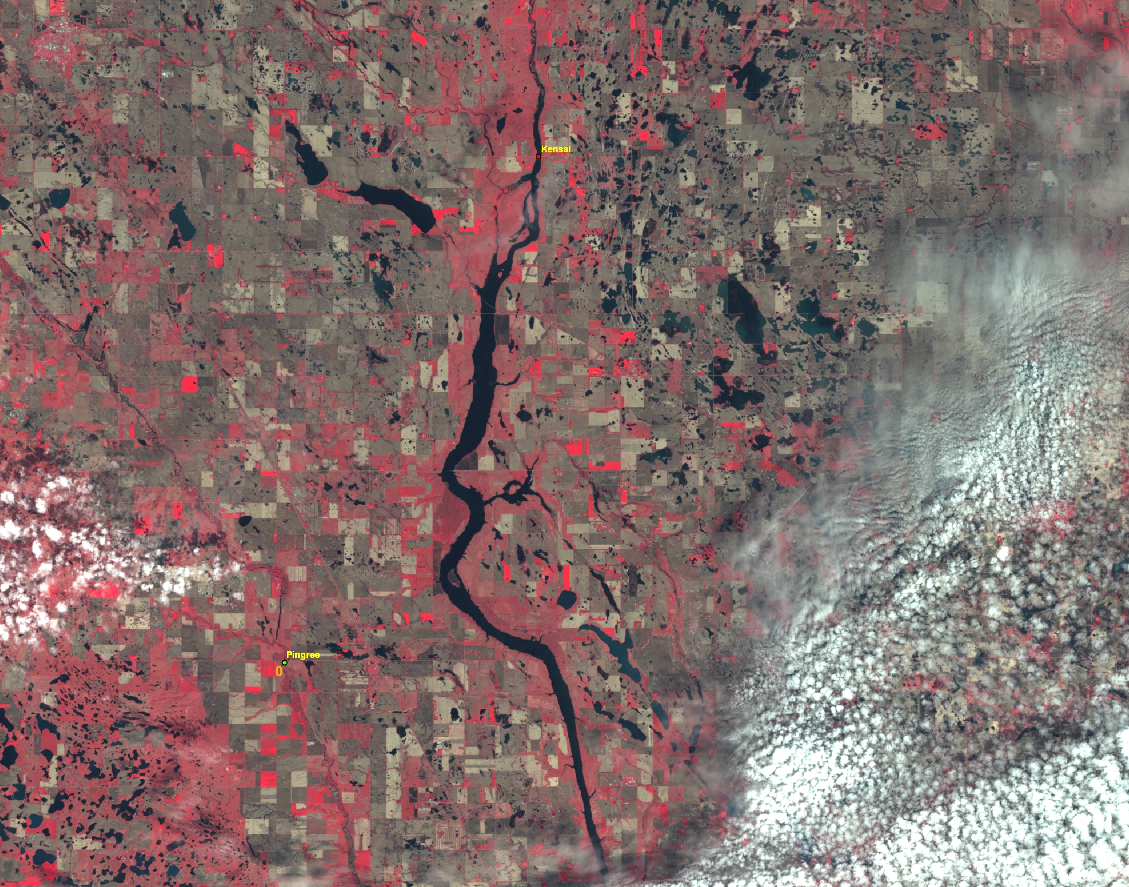
James River in ND - 2009-05-28
|
The James River near Kensal, ND remains in moderate
flood. Devils Lake is visible to the north in this
Landsat image.
This scene is GIS-ready with the additional
.jgw file.
|

|
|
James River at Kensal, ND - 2009-05-28
|
The James River near Kensal, ND remains in moderate
flood.
This scene is GIS-ready with the additional
.jgw file.
|

|
|
James River at LaMoure, ND - 2009-04-19
|
The James River at LaMoure, ND is still above flood
stage. This Thematic Mapper image from Landsat 5 was
taken at the crest of the flooding on April 19, 2009.
TM bands 4-3-2 are displayed as RGB.
As of 3pm April 22, the river is receding at 15.31 ft,
still above the nominal flood stage of 14'.
This scene is GIS-ready with the additional
.jgw file.
|

|
|
James River at Columbia, SD - 2009-04-19
|
This Thematic Mapper image of the James River is from
Landsat 5, taken April 19, 2009. The RGB band combination
is 7-5-3, chosen from this margin image to best delineate
the extent of water over land.
Text of the latest warning:
THE FLOOD WARNING CONTINUES FOR
THE JAMES RIVER NEAR COLUMBIA
- until further notice...
- At 09AM Wednesday the stage was 19.7 feet...
- Record flooding is occurring and record flooding is forecast...
- Flood stage is 13.0 feet...
- The river rose above flood stage and will continue rising to near
19.8 feet by this evening. The river should begin falling the
the morning of Monday May 4 2009.
- At 19.6 feet...the water overtops the levee at the park in
Columbia..
This scene is GIS-ready with the additional
.jgw file.
|

|
|
Fargo and area south - 2009-04-03
|
This moderate resolution image shows the broader region including the
similar snow-free/inundated area south of Fargo. This image supports the
talking point that there is substantial snow through the area still to be
melted.
|

|
|
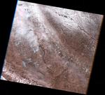
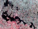
Grand Forks area RadarSAT image - 2009-03-28
|
This is a Canadian RadarSAT image of the Grand Forks area from March 28.
RadarSAT is not affected by cloud cover. See the legend for an
explanation of how to interpret the colors in this image. Interpretation
is qualitative only - basically pink/magenta is standing water, as it
fades to blue/purple there is varying moisture and snow cover,
green-cyan is likely bare fields, yellow is rougher bare fields, and
red is very rough, probably buildings. If you try to just pay attention
to the pink-magenta darkening to blue/purple, you're seeing standing
water or very wet areas.
|

|
|


