- Home
- Snow Information
- National Analyses
- Interactive Maps
- 3D Visualization
- Airborne Surveys
- Snowfall Analysis
- Satellite Products
- Forecasts
- Data Archive
- SHEF Products
- Science/Technology
- NOHRSC
- GIS Data Sets
- Special Purpose Imagery
- About The NOHRSC
- Staff
- NOAA Links
- Snow Climatology
- Related Links
- Help
- Help and FAQ
- Site Map
- Contact Us
- Please Send Us Comments!

|
Special Purpose Imagery > Special Purpose Imagery Archive
Special Purpose Imagery Archive
The following are ad hoc-generated images for special projects, grouped by
geographic region. Note: some of the linked images are large georeferenced
JPG or TIFF files that have been compressed using the tar and
gzip utilities.
| Midwest Region |
|---|
Wabash River near Terre Haute, IN - 2013-04-30
|
This Landsat 7 image shows moderate flooding along the Wabash
River from Terre Haute, IN down to Mt Carmel, IL. This is a
false color composite that uses bands 5-4-3 as
Red-Green-Blue. The LandsatLook scene is from path 22,
rows 33 and 34. Additional XML data for GIS can be found
here.
This scene is GIS-ready with the additional
.jgw file.
|

|
|
Wabash and Ohio Rivers near Mt Vernon, IN - 2013-04-30
|
This Landsat 7 image shows the moderate flooding along the
Wabash River (flowing from the top) as it meets the
Ohio River (flowing from the the upper right).
This is a false color composite that uses bands 5-4-3 as
Red-Green-Blue. The LandsatLook scene is from path 22,
rows 33 and 34. Additional XML data for GIS can be found
here.
This scene is GIS-ready with the additional
.jgw file.
|

|
|
Ohio and Mississippi Rivers at Cairo, MO - 2011-05-03
|
This Landsat 5 image shows the flooding around the
confluence of the Ohio River (flowing from the upper right)
and the Mississippi River (flowing from the left).
This is a false color composite that uses bands 5-4-3 as
Red-Green-Blue. The scene used was L5022034_03420110503.
|

|
|
Ohio and Mississippi Rivers to New Madrid, MO - 2011-05-03
|
This Landsat 5 image shows the flooding around the
confluence of the Ohio River (flowing from the upper right)
and the Mississippi River (flowing from the upper left),
continuing on down the Mississippi River past New Madrid, MO.
This is a false color composite that uses bands 5-4-3 as
Red-Green-Blue. The scenes used were L5022034_03420110503 and
L5022035_03520110503.
This scene is GIS-ready with the additional
.jgw file.
|

|
|
Ohio and Wabash Rivers near Mt Vernon, IN - 2011-05-03
|
This Landsat 5 image shows the flooding around the
confluence of the Wabash River (flowing from the top)
and the Ohio River (flowing from the right).
This is a false color composite that uses bands 5-4-3 as
Red-Green-Blue. The scene used was L5022034_03420110503.
This scene is GIS-ready with the additional
.jgw file.
|

|
|
Wabash River at Terre Haute, IN - 2010-05-24
|
This Landsat 5 image is a false color composite using TM
bands 7-5-3 as Red-Green-Blue.
The latest river stage at Terre Haute is 16.41 ft at
2:00 PM on 5/24. Flood stage is 14.0 ft.
This scene is GIS-ready with the additional
.jgw file.
|

|
|
Red River at Stanton, KY - 2010-05-03
|
This Landsat 7 image is a false color composite using TM
bands 4-5-1 as Red-Green-Blue. This is displayed at 15 meter
resolution, double the usual. The coloring derived from the
30 meter band combination has been applied to the panchromatic
TM band 8. Mechanical problems onboard LandSAT-7 leaves gaps
in the data, but the increased spatial resolution makes the
image worthwhile.
In comparison, below is an image of a more normal river
extent via Google Maps.

There is more serious flooding not visible just to the west
of this satellite image, in Frankfort, Boston, and Lockport.
This scene is GIS-ready with the additional
.jgw file.
|

|
|
Kentucky River at Ravenna, KY - 2010-05-03
|
This Landsat 7 image is a false color composite using TM
bands 3-2-1 as Red-Green-Blue. The river overlay is part of
the NHD (National Hydrography Database), obtained online
from the Ketucky Geologic Survey.
This scene is GIS-ready with the additional
.jgw file.
|

|
|
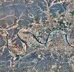
Outline of Nashville, TN flooding - 2010-05-04
|
This is a rough outline of the flooding in Nashville, TN
derived from the MODIS TERRA image from 05/03/2010. The
outline is superimposed over the NAIP orthophoto.
The yellow outline is flooding on 5/3, while the
blue outline is flooding on 5/4.
Orthophoto images are available from
Tennessee Spatial Data Server
This scene is GIS-ready with the additional
.jgw file.
|

|
|
Terra image of Nashville, TN flooding - 2010-05-04
|
This is a rough outline of the flooding in Nashville, TN
derived from the MODIS TERRA image from 05/03/2010.
The yellow outline is flooding on 5/3, while the
blue outline is flooding on 5/4.
This scene is GIS-ready with the additional
.jgw file.
|

|
|
40 more...
|

